
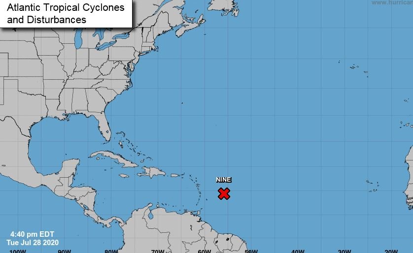
A tropical disturbance known currently as Cyclone #9 is expected to develop into a tropical storm by early Wednesday (July 29) said the Miami-based National Hurricane Center (NHC).
According to the NHC, the tropical disturbance which is currently in the Eastern Caribbean sea is expected to bring heavy rains and tropical storm-like conditions to the countries in the area.
Tropical storm warnings have already been issued in Puerto Rico, Vieques, Culebra, the U.S. Virgin Islands, the British Virgin Islands, Antigua, Barbuda, Montserrat, St. Kitts, Nevis, Guadeloupe, Martinique, St. Martin, Saba, St. Eustatius and St. Maarten.
According to the NHC the system is moving toward the west-northwest near 23 mph (37 km/h), and this general motion is to continue with some slight reduction in forward speed expected over the next few days.
The NHC further said the projected track for the system is forecasted to move through the Leeward Islands on Wednesday, near or over the Virgin Islands and Puerto Rico Wednesday night, and near or over Hispaniola on Thursday.
“The details of the long-range track and intensity forecasts are more uncertain than usual since the system does not have a well-defined centre and could move over portions of the Greater Antilles later this week,” the NHC said.
The tropical cyclone is expected to produce total rain accumulation of 3 to 6 inches with maximum amounts of 10 inches across the northern Leeward Islands, British and U.S. Virgin Islands and Puerto Rico.
Every year, tropical storms tracked by the National Hurricane Center are given a specific name when they reach the speed of 39 mph.
As of 5:00 p.m. on Tuesday the storm had sustained winds of 40mph, come Wednesday it could be named Tropical Storm Isaias;it would be the seventh named storm of the 2020 season.